Developed and provided by Alexander County Mapping
(click on any below to view full map)
Interactive, hazard maps, with zoom capability (PDF) require a copy of Adobe Acrobat Reader. Click here to obtain a free copy if needed.
![]()
Developed and provided by Alexander County Mapping
(click on any below to view full map)
Interactive, hazard maps, with zoom capability (PDF) require a copy of Adobe
Acrobat Reader. Click
here to
obtain a free copy if needed.
AutoCad drawings are also available to view this information.
Contact Alexander County Emergency Management or Alexander County Mapping/GIS for the proper computer files.
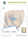
| Flood plain Map Alexander County 100 year | Flood plain Map Alexander County 500 year |
 |
 |
|
Click here
for a scaleable PDF Version |
Click here
for a scaleable PDF Version |
| Flood plain Map of Taylorsville 100 and 500 year | |
|
|
|
|
Click here
for a scaleable PDF Version |
|
| Tornado History Map - Alexander County | Inundation Map - Oxford Dam |
 |
|
|
Special Concern area - high water prone - Town of Taylorsville |
|
| Map 1 - Northwood / Northmont | Map 2 - South Center St. |
 |
 |
Other hazards in Alexander County are considered as county wide or have the potential to occur in any location. Hazardous materials, transportation is considered as being within one mile either side of a transportation route. Since this encompasses greater than 50% of the county population, the threat is considered to be county wide.