Hazard Identification
(See
sources of information below)
Wildfire (Forest
Fires):
There are three types of wildfires.
| Surface Fire |
This type burns slowly along the floor of a forest. This is the most common type of wild fire.
This type of fire can damage or
even kill trees. |
| Ground Fire |
Usually occurs
from a lightning strike.
This type of fire burns on or below the forest floor. |
| Crown Fire |
This fire is
quickly spread by the wind. It tends to jump among the crowns of trees. |
| All are generally characterized by very thick smoke. |
Earthquake:
An earthquake is a series of vibrations induced in the earth's crust by the abrupt rupture and rebound of rocks in which elastic strain has been slowly accumulating. It is caused by a slip on a fault, which is a thin zone of crushed rock between two blocks of rock. The fault can be any length, from a few millimeters to thousands of kilometers. It is a fracture in the crust of the earth along which rocks on one side have moved relative to those on the other side. An earthquake occurs when stresses in the earth's outer layer push the sides of the fault together. Stress builds up and the rocks slips suddenly, releasing energy in waves that cause the shaking.
Earthquakes can cause severe damage to property and
extensive loss of life. An earthquake
will not kill by itself. However, an
earthquake may cause extensive structural damage and collapse that could cause
fatalities and injury.
Earthquakes can occur at any time of the day and
are not related to weather patterns. An
earthquake cannot be prevented, although mitigation measures can be taken,
particularly structure measures, to reduce the impact that an earthquake has on
the surface.
The National
Earthquake Information Center records 12,000 to 14,000 earthquakes a year.
The majority are very low vibrations and cannot be felt by people on the
surface.
Flooding:
Flooding occurs from a number of weather and
non-weather related reasons. Floods
typically occur from prolonged rainfall, but they can also occur from snowmelt,
ice jams, and dam failures. Floods also
occur in all 50 states, particularly in low-lying communities, near a water
source, or downstream from a dam.
Flooding can cause destruction to property and
injury and death to people. Since 1900,
10,000 lives have been lost to flooding.
A 1987 study concluded that over 9 million households and $390 billion
in property are at risk from the 1 percent annual chance flood (100 year flood
plain).
There
are seven types of flooding in the United States Riverine Flooding, Flash
Floods, Alluvial Fan Floods, Ice Jam Floods, Dam Break Floods, Local Drainage
or High Groundwater Levels, and Fluctuating Lake Levels
Riverine Flooding: This is the most common type of flooding. This occurs when a river or stream overflows its banks. In large rivers, it usually occurs after a serious, large-scale weather event. In streams, this can occur from more localized weather systems.
Flash Floods: Flash floods typically encompass a quick rise of high velocity
water and large amounts of debris.
Factors that contribute to flash flooding include the length and
intensity of rain and the steepness of watershed and stream gradients. Other factors influencing flash floods
include the amount of watershed vegetation, natural and artificial water
storage, and the configuration of the streambed and floodplain. Flash floods
not only occur from weather systems, but also from a dam failure, or breakup of
ice. This type of flood poses the most
risk to property and lives. Because of
the rapid rise of the water levels, a large percentage of flood deaths occur
from motorists who underestimate the depth and velocity of the floodwaters and
attempt to cross flooded areas. This
typically occurs when a weather event quickly drops an extensive amount of water. Walls of water from this type of event can
reach 15 to 20 feet.
Dam Break Floods: Results from structural
failures of dams.
Local Drainage or High
Groundwater Levels: Heavy precipitation from local weather
events may produce flooding outside of delineated flood plains. If the local soil cannot handle
precipitation through infiltration and runoff, the water may accumulate. During winter, frozen ground and accumulated
snow will contribute to this problem.
This type of flooding generally occurs in flat and urban areas. High groundwater levels may cause leakage in
susceptible basements.
Fluctuating Lake Levels: Lake levels can change over a short period of time, over a
season, or on a long-term basis. Heavy
rain or snow can influence levels. All
lakes are susceptible to changes in water level, but the problem seems to occur
most often in lakes that are landlocked or have inadequate outlets for
maintaining a balance between in and outflow.
These type of lakes can fluctuate from 5 to 15 feet over an extended
period of time.
Due to the severe consequences from flooding, local
governments should pay close attention to flood warnings and forecasts. These mitigation measures decrease property
damage by an estimated $1 billion annually.
The National Weather Service is
responsible legally for weather forecasting and warning. NWS uses the stream
gauging stations that the USGS operates and maintains nationwide, including 98
percent of gages used for real-time forecasting.
In the early 1960s it was recognized that there
needed to be a standard of evaluating flood risk throughout the United
States. This resulted in the 100-year
or 1-percent-annual chance flood. This
assessment delineates a degree of risk and damage worth protecting against, but
not deemed to be worthy of imposing stringent requirements or burdens of
excessive costs on property owners.
The 100-year flood represents a compromise between minor floods and
major floods.
Computed water surface elevations are combined with
topographic mapping data to develop the Flood Insurance Rate Maps (FIRM). This is an important planning tool to
determine where development would reside within flood prone areas. Insurance companies use the FIRMs to
determine flood insurance rates.
Alexander County (370398) is a participant in the National Flood Insurance Program, making
citizens eligible for flood insurance.
Drought:
A drought is roughly defined as a condition of
abnormally dry weather within a geographic region where some rain is usually
expected. This is caused by a lack of
precipitation in conjunction with wind, high temperatures, and low
humidity. This lack of rain in a region
results in a number of problems. There
are varying degrees of severity in a drought.
This severity depends on the demand on water in a region, duration, and
intensity. Problems of a drought can include:
·
Diminished
water supplies or reduction of water quality.
·
Undernourished
livestock and wildlife.
·
Crop
damage
·
Increased
fire hazards
·
Reduced
forest productivity
·
Damage
to fish and wildlife habitat
Indirect Impacts:
·
Reduced
income for farmers and agribusiness
·
Increased
prices for food and lumber
·
Unemployment
·
Reduced
tax revenues because of reduced expenditures
·
Increased
crime
·
Foreclosures
on bank loans to farmers and agribusiness
There are four types of droughts:
| 1. | Meteorological Drought – This is a reduction of precipitation over time. This definition is regionally based. In the United States, this is indicated by less then 2.5mm of rainfall in 48 hours. This is the first indication of a drought. |
| 2. |
Agricultural
Drought – This occurs when soil moisture cannot meet the demands of a
crop. This type of drought happens
after a meteorological drought but before a hydrological drought. |
| 3. |
Hydrological
Drought – This type refers to reduction in surface and subsurface water
supplies. It is measured through stream
flow and water levels in lakes, reservoirs, and groundwater. |
| 4. |
Socioeconomic
drought – This occurs when water shortages affect people, either in terms of
water supply or economic impacts (i.e. loss of crops so price increases). |
The
occurrence of large snowstorms, ice storms, and severe blizzards has a
substantial impact on communities, utilities, and transportation systems, and
often results in loss of life due to accidents or hypothermia. In addition to the impacts on
transportation, power transmission, communications, agriculture, and people,
severe winter storms can cause extensive coastal flood-erosion, and property
loss.
Severe winter storms display themselves in a wide variety of ways including heavy snow, blizzards, freezing rain, ice pellets, and extreme cold. Severe winter storms are extra-tropical cyclones fueled by strong temperature gradients and an active upper-level jet stream. The storms that hit North Carolina usually form in the Gulf of Mexico or off the southeast Atlantic Coast. In North Carolina, very few of these result in a blizzard.
Hurricanes:
Hurricanes are devastating natural events on the east coast. More than 36 million people reside in the counties along the Gulf of Mexico and the Atlantic Ocean. This exposes a large amount of a state’s population and property to tropical events.
Hurricanes have a number of conditions necessary to
occur. This includes a pre-existing
weather disturbance, warm tropical oceans, moisture, and relatively light winds
aloft. If these all come together, they
can produce a hurricane which can lead to violent winds, high waves, torrential
rains, storm surge, tornados, and floods. Basically, a hurricane is a type of
tropical cyclone, which is a low pressure system that generally forms in the
tropics.
Hurricane eyes move around 10 - 15 mph. Hurricanes typically move westward at first
and become stronger as time goes on.
Hurricanes then typically turn from the equator and pick up speed. Most hurricanes turn east after they reach
temperate latitudes. Many end up as
weak storm centers over cool oceans.
If a hurricane continues to move west and
encounters land, strong winds and heavy rain can hit an area for many
hours. As the ‘eye’ of the hurricane
hits an area, the high winds and rain stop.
Less then an hour later, the eye passes and the damaging winds and rains
continue. Hurricanes tend to weaken
after reaching land because they are not receiving energy from the evaporation
of warm seas. The wind also encounters
friction from the rougher land surface.
Winds die down first, while heavy rains continue.
When a hurricane is initially formed, a number of
agencies and departments keep track of its progress. A multitude of information is collected, including pressure,
temperature, and wind speeds. This
information is very important to formulate predictions on landfall and
severity, so communities in its path can be warned
Housing is very susceptible to damage from
hurricanes. The greatest wind forces on
houses occur on their sides. Since
hurricane force winds push for extended periods of time, it can push a frame
out of alignment or lift it off its foundation. It seeks out weak points such as windows and doors. The wind can also pick up heavy debris and
smash it against residences. When a
wind blows against a house, it puts pressure on the side it is blowing
against. The opposite side of the house
experiences low pressure. Therefore, if
the wind enters the house from the blowing side (i.e. blowing out a window, etc),
the sudden pressure buildup in the house can cause doors, windows, and other
weak places to pop out. If the wind
doesn’t destroy a house, then residents need to worry about the heavy rain
producing enough floodwaters to enter the house. A typical hurricane drops 6 – 12 inches of water on the area it
crosses. Tornados often form on the
fringes of the storm.
Each year, about 10 tropical storms develop. Many of these remain over the ocean, but approximately 6 become hurricanes each year. Hurricane strength is defined by the Saffir/Simpson Hurricane scale.
The Saffir/Simpson Hurricane Scale
|
Category |
Definition-Effects |
|
1 |
Winds : 74-95 mph
(64-82 kt) |
|
2 |
Winds : 96-110 mph
(83-95 kt) |
|
3 |
Winds : 111-130 mph
(96-113 kt) |
|
4 |
Winds : 131-155 mph
(114-135 kt) |
|
5 |
Winds : 155+ mph
(135+ kt) |
Hurricanes are given names by an
international committee. This reduces
confusion when two or more tropical cyclones occur at the same time. The list repeats itself every three years,
but if a hurricane is especially damaging, the name is retired.
Severe
Thunderstorms:
Thunderstorms are underrated in the damage, injury,
and death they can bring. Lightning precedes thunder because lightning causes
thunder. As lightning moves through the
atmosphere, it can generate temperatures up to 54,000 degrees Fahrenheit. This intense heating generates shockwaves
which turn into sound waves, thus generating thunder.
Warm, humid conditions encourage thunderstorms as
the warm, wet air updrafts into the storm. As warm, moisture rich air rises, it forms cumulus nimbus clouds,
thunderstorm clouds, usually with a flattened top or an anvil shape, reaching
to 40,000 feet or more. If this air is unstable, the conditions are then there
to cause hail, damaging winds and tornados.
As a thunderstorm grows, electrical charges build up within the clouds. Oppositely charged particles exist at the ground level. These forces become so strong that the air’s resistance to electrical flow is overcome. The particles from both top and bottom then race towards each other to complete a circuit. Charge from the ground then surges upward at nearly one third the speed of light to produce lightning.
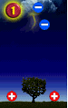

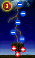
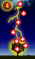
Figure Source: USA TODAY
Each year lightning kills about 50 – 100 people,
mostly during the spring/summer season.
Typical thunderstorms last anywhere from ½ to 1 hour. Most lightning strikes occur in the
afternoon. 70% occur between noon and
6:00pm. This is because as air
temperatures warm, evaporation increases.
Sundays have 24% more deaths from lightning then any other day, followed
by Wednesday. Lightning reports reach
their peak in July.
Men are hit by lightning four times more often then
women. Men account for 84% of lightning
fatalities and 82% of injuries.
However, the actual number of deaths and injuries due to lightning have
decreased over the last 35 years. This
is attributed to improved forecasts and warnings, better lightning awareness,
more substantial buildings, socioeconomic changes, and improved medical care.
In the United States, the
National
Weather Service recorded 3,239 deaths and 9818 injuries due to lightning
strikes between 1959 and 1994. Only 20%
of lightning strikes cause immediate death.
70% of lightning strike victims that survive experience residual
affects, most commonly affecting the brain (neuropsychiatric, visual, and
auditory). These effects can develop
slowly.
Damage to property from direct or indirect
lightning can take the form of an explosion, a burn, or destruction. Damage to property has increased over the
last 35 years. This is probably due to
increased population. The National
Weather Service recorded 19,814 incidents of property damage between 1959 and
1994. Yearly losses are estimated at
$35 million by the National Weather Service. This amount is compiled from newspaper reports, but many strikes
are not reported. The National Lightning Safety Institute
estimates damages at $4 to $5 billion. This information is compiled from
insurance reports and other sources that keep track of weather damages.
Thunderstorm
winds also cause widespread damage and death.
Thunderstorm ‘straight line’ wind occurs when rain-cooled air descends
with accompanying precipitation. A thunderstorm
is considered severe when winds exceed 57.5mph. At the very extreme, winds of 160mph have been recorded. These winds can smash buildings and uproot
and snap trees, and are often mistaken for tornados.
‘Downbursts’
can occur during a thunderstorm. This
is an excessive burst of wind that is sometimes confused with tornados. These are defined as a surface wind in
excess of 125 mph caused by a small scale downdraft from the base of a
convective cloud. A downburst occurs
when rain-cooled air within a convective cloud becomes heavier than its
surroundings. Since cool air is heavier
than warm air, it rushes toward the ground with a destructive force, exactly
what triggers the sudden down rush is still unknown.
A
downburst appears to strike at a central point and blow outwards. (Picture a
bucket of water dashed against grass.
If it hits straight on, the grass will be flattened in a circular
pattern. If it hits at an angle, the
grass will be flattened in a teardrop pattern). Downbursts resulted in 268 deaths and 8 related accidents between
1974 and 1982.
Downbursts
can be further classified into two categories:
Microburst: Less than 2 1/2 miles wide at the surface, duration less than 5
minutes and winds up to 146 miles per hour.
Macroburst: Greater than 2 1/2 miles wide at the surface, duration of 5-30 minutes with winds up to 117 miles per hour.
Tornados:
Tornados are produced during severe thunderstorms,
which are created near the junction between warm, moist air and cold, dry air. Tornados derive their energy from the heat
contained in warm, moist air masses.
Tornados do not form during every thunderstorm. They occur when the moist, warm air is
trapped beneath a stable layer of cold dry air by an intervening layer of warm
dry air. This is called an
inversion. If this is disturbed, the
moist air will push through the stable air that is holding it down. This warm air will then condense as the
latent heat it holds is released. This air will then spiral upwards. With the help of different types of winds,
this spiral gains speed, producing a tornado.
A tornado path is generally less then .6 miles
wide. The length of the path ranges
from a few hundred meters to dozens of kilometers. A tornado will rarely last
longer then 30 minutes. The combination
of conditions that cause tornados are common across the southern U.S. in early
spring, especially in April and May.
Tornados have been recorded as lifting and moving objects weighing more
then 300 tons up to 30 feet. They can
also lift homes off of their foundations and move them 300 feet. They collect an incredible amount of debris,
which they can whirl out of their winds at high velocities. Tornados are
usually accompanies by heavy rain.
Tornados can cause large amounts of property
damage, injury, and death. Although more twisters hit the states that run from
Texas up through Oklahoma, Kansas and into Nebraska, more people are killed by
the tornados that land in the Southeast. The reasons given for the disparity
include the different housing, geography and population density and the greater
tendency of tornados in the Southeast to strike at night. Between 1950 and 1997, the Tornado Alley
states of Texas, Oklahoma, Kansas, Nebraska and Missouri had 13,808 tornados,
according to data compiled by the National Storm Prediction Center. In those
storms, 1,132 people died. In Alabama, Arkansas, Louisiana, Mississippi,
Georgia, Florida, Tennessee, North Carolina and South Carolina, there were
9,178 tornados and 1,648 deaths.
The National Weather Service issues a tornado watch
for a specific location when the conditions are ripe for tornados, and they
are expected within a few hours. A
tornado warning is issued when a tornado has actually been sighted or indicated
by weather radar.
|
Category |
Maximum Wind Speeds |
Equivalent Saffir-Simpson Scale |
Typical Effects |
|
40 – 72mph |
NA |
Gale Tornado. Light Damage: Some damage to chimneys; breaks twigs and branches off trees;
pushes over shallow-rooted trees; damages signboards; some windows broken;
hurricane wind speed begins at 73mph. |
|
|
73 – 112 mph |
Cat 1/2/3 |
Moderate Tornado. Moderate damage; Peels surfaces off roofs;
mobile homes pushed off foundations or overturned; outbuildings demolished;
moving autos pushed off the roads; trees snapped or broken. |
|
|
113 – 157 mph |
Cat 3/4/5 |
Significant Tornado. Considerable damage: Roofs torn off frame
houses; mobile homes demolished; frame houses with weak foundations lifted
and moved; boxcars pushed over, large trees snapped or uprooted; light-object
missiles generated. |
|
|
158 – 206 mph |
Cat 5 |
Severe Tornado. Severe damage: Roofs and some walls torn
off well-constructed houses; trains overturned; most trees in forests
uprooted; heavy cars lifted off the ground and thrown; weak pavement blown
off roads. |
|
|
207 – 260 mph |
Cat 5 |
Devastating Tornado. Devastating damage: Well constructed homes
leveled; structures with weak foundations blown off some distance; cars
thrown and disintegrated; large missiles generated; trees in forest uprooted
and carried some distance away. |
|
|
261 – 318 mph |
NA |
Incredible Tornado. Incredible damage: strong frame houses
lifted off foundations and carried considerable distance to disintegrate;
automobile-sized missiles fly through the air in excess of 200 ft; trees
debarked; incredible phenomena will occur. |
|
|
F6 – F12 |
Greater then 319
mph. |
NA |
The maximum wind speeds of
tornados are not expected to reach the F6 wind speeds. |
Hazardous Materials:
Any area that manufactures hazardous materials, or contains transportation routes (roads, rail) that transports hazardous materials are at risk for a hazardous material event. Approximately 6,774 HAZMAT (hazardous materials) events occur each year nationwide. On the average 991 will be railway events. Trucks are responsible for most of the remainder of events. The average distance for trip lengths for gasoline transport is 28 miles, 260 miles is the average length for chemical trucks. Even though trucks account for most accidents, it is railway transport that has the greatest potential for concern in many areas. Collisions and derailments can cause very large spills as it is rare that a single car will be damaged. Extremely hazardous substances, as defined by the EPA, can pose as serious threat, whether by rail or other ground transportation.
HAZMAT spills
occur at fixed sites each year. Natural
disasters, such as floods and earthquakes can cause HAZMAT releases or disturb
old HAZMAT release sites (Superfund sites).
These same disasters can make it difficult to contain these events once
they occur. Also, natural disasters can
limit access to the spill, waterlines for fire suppression may be broken, and
response personnel and resources may be limited. Flooding and high winds can
quickly spread the contaminant, threatening agriculture, water supply and air.
HAZMAT releases pose short and
long term threats to people, wildlife, vegetation, and the environment. HAZMAT materials can be absorbed through
inhalation, ingestion, or direct contact with the skin.
Fixed Nuclear Facility:
Portions of Alexander County fall within the 50-mile ingestion exposure pathway of the Duke Energy,
McGuire Nuclear Station. The 50-mile radius of the ingestion exposure EPZ is based on a number of considerations. One of those considerations is that the downwind range, potentially threatened by contamination, would generally be limited to about 10-miles or less from the power plant because of wind shifts, wind speed during the release, and radioactive decay. Another is that the particulate material from a radioactive plume would have been deposited on the ground within 50 miles of the facility.There have been no incidents at McGuire Nuclear Power Plant that have affected Alexander County. Residents of Alexander County would be required to shelter in place during a release of a radiological hazard, if the conditions indicate that the contaminant plume (cloud) would pass over an area of the county. Limited evacuation of selected households is possible, but not considered likely to be needed, based on the evaluation of possible incidents by both Duke Power and the North Carolina Division of Emergency Management (NCEM). It has been determined that an event at McGuire Nuclear Station, that would have an adverse effect on citizens or property within Alexander County is less than 1%. In depth hazard vulnerability assessments have been ongoing with this facility for more than 20 years. Such assessments are beyond the scope of this hazard mitigation plan and are available from the NC Division of Emergency Management, Duke Energy, the Nuclear Regulatory Commission (NRC) and the Federal Emergency Management Agency (FEMA).
Terrorist
Activity:
Terrorism
is the use of force or violence against persons or property in violation of the
criminal laws of the United States for purposes of intimidation, coercion or
ransom. Terrorists often use threats to create fear among the public, to try to
convince citizens that their government is powerless to prevent terrorism, and
to get immediate publicity for their causes.
The
Federal
Bureau of Investigation (FBI) categorizes terrorism in the United States as
one of two types--domestic terrorism or international terrorism.
Domestic
terrorism involves groups or individuals whose terrorist activities are
directed at elements of our government or population without foreign direction.
International
terrorism involves groups or individuals whose terrorist activities are
foreign-based and/or directed by countries or groups outside the United States
or whose activities transcend national boundaries.
There are numerous documents regarding the efforts
of the United States, the states themselves and local jurisdictions to counter
terrorist threats of both a domestic and international nature. The
U.S. Department of Homeland Security
is charged with the coordination of national investigative and response
organizations, to determine threat levels and to issue warnings to the public
through local, state and national official sources.
Domestic terrorist acts such as the 1995 Oklahoma City bombing of the Murrah Federal Building, which left 168 persons dead and international terrorist acts such as the destruction of both towers of the World Trade Center in 2001, which killed more than 6,000, have shocked and awakened our citizens to the very real threats and acts of small groups of terrorist through out the world. The use of biological weapons, as in the case of the anthrax letters in 2001, can cause nationwide panic. While such panic is unfounded, public perception that they and their family are in danger often frightens otherwise rational people into thinking "am I next".
Other or
unknown hazards (biologics, disease, etc.) :
This particular threat is perhaps one of the most troubling and causes planners considerable concern because they are unknown. There are over 60,000 known chemicals as well as hundreds of diseases that effect human populations as well as livestock and there are naturally occurring biological concerns. A fire at a plastics recycling center, for example, may cause a significant local environmental impact from smoke and water runoff, smoke may be toxic and cause death or injury to the human population as well as local livestock. Water runoff may kill aquatic life and contaminate drinking water supplies. Additional hazards from smoke may be as minor as traffic congestion and accidents in the immediate area to long term breathing difficulty in exposed populations. This one example is an indicator of an unknown where the original product (plastics) present little concern, but when burned cause numerous hazards. Other concerns such as anthrax and foot and mouth are often classed as unknowns until laboratory results have been examined. This can sometimes take days or weeks.
Power Failure:
A major electrical power failure is defined as a failure of the electrical distribution system that will exceed twenty four hours in duration and effect greater than 33% of the geographical area of the county. Electrical distribution systems can be interrupted for a number of reasons, but those that have historically been the main cause are high winds (tornados, hurricanes and severe thunderstorms) and severe winter storms, such as ice. A prolonged major electrical distribution system failure during the middle of winter accompanied with very cold temperatures can have dramatic effects on a population. There are two major distributors of electricity in Alexander County. Duke Energy and EnergyUnited. Duke Energy reports 7,620 customers with a reliability rate of 99.97% or 0.27 days where electricity may not be available. Energy United reports 6,176 customers with a reliability rate of 99.83% or 0.28 days where electricity may not be available. This is less than 1% and therefore not considered a threat for mitigation purposes.
Mass Casualty:
Defined
as any occurrence in which twenty (20) or more persons are killed or sustain
injury.
Large Structural Fires:
Generally
a large structure is defined as any structure exceeding 25,000 square feet.
Large structural fires therefore would include fully involved structures of
this size or greater. Hospitals, government centers, manufacturing facilities,
warehouses, barns, etc. Multiple stories may be involved as well and constitute
square footage.